 Precipitaciones durante 2021 en Santa Cruz y Sur de Chubut
 Activador Ruminal de elaboración Casera
 Libro: Servicios Ecosistémicos y Biodiversidad de los Recursos Naturales de Santa Cruz
 Aprovechamiento de pasturas en estado reproductivo y desempeño de corderas en la Patagonia Austral
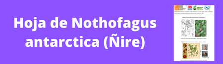 Hoja de Nothofagus antarctica (Ñire)
 Catálogo de Padres Corriedale Año 2022
 Díptico: ganadería ovina extensiva. Se acerca el momento del servicio
The MARAS monitoring system (acronym for Monitoring Arid and Semiarid Lands) has been developed to evaluate long-term changes of vegetation and soil in semi-arid areas of Argentina and Chile with an initial array of 379 ground-based monitors that share a single sampling protocol. Sites were set up between 2008 and 2014 in 13 biozones with different vegetation types of Patagonia region, from shrublands to grasslands, most of them under extensive sheep farming. The objective of this paper was to analyze the initial database in order to establish minimum sample sizes at plot, regional and multitemporal scales, and to evaluate the power to detect changes. Floristic composition, diversity and vegetation cover were assessed with two 50 m line transects with 500 interception points. Gap intercept lines 50 m long were used to recognize >5cm interpatches (areas that loose resources) and >10 cm patches (resource sink areas). Eleven LFA (Land Function Analysis) indicators were recorded in bare soil patches and combined to asses: Soil stability, Infiltration and Nutrient cycling. Single composite soil samples were taken at 0-10 cm depth in patches and interpatches to test for organic carbon, texture and other soil properties. Information was stored in a unified database. At a plot scale the sampling effort cover, stability LFA index and interpatch length were estimated with 15%,10% and 25% errors respectively. Species count underestimates total plot richness, but both variables are correlated significantly (R2=0.80). At a regional scale the established network density provides estimation of means for the main biozones within 10% error for vegetation cover, LFA stability index and species richness, and 15% error for Interpatch length. In multi-temporal analysis a set of 10 monitors would provide estimations with minimum detectable changes of +/-2.2 points of cover, +/-1.8 species, +/-10 points of LFA and +/-23 cm in interpatch length. Training and cross standardization of observation teams have the potential to reduce observational errors. The base line drawn by the MARAS system will be useful to describe change or stabilization of these arid lands with a detail that was not possible in the past with multiple techniques and isolated data bases.
| Adjunto | Tamaño |
|---|---|
| 2.46 MB |